| |
THE MAP OF CONNECTIONS
During many surveys I discovered that the Irish Border is often perforated. Gates are set in hedgerows for the convenience of farmers, stepping stones and community-built bridges span rivers, walkers’ routes and muddy by-ways go wherever they please. These kinds of connections have always been there, although I think it is fair to say that their numbers have increased during the Peace Process. Roads blocked or cratered during the Troubles are being re-connected at a rate too fast for the Ordnance Survey to keep up with. On the local level cross-border movement is quietly happening, unchecked and often unmapped.
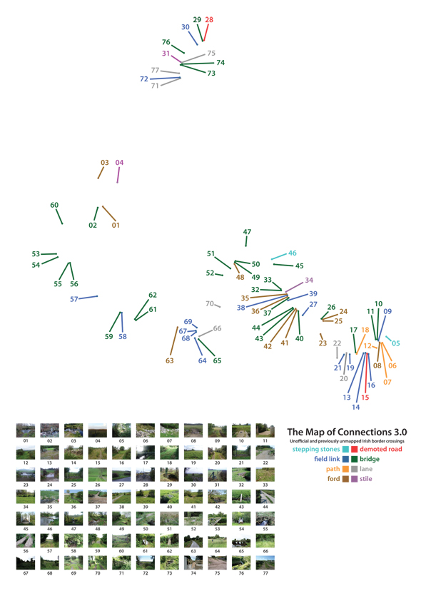
Image one, overview.
This ground-level permeability seemed a good topic for a new map, a map that tries to throw the borderline in perpendicular and shows it as a place of connection rather than division. I charted unofficial border-crossings, not found on any other map. The Map of Connections was to chart the unofficial and the unsanctioned.
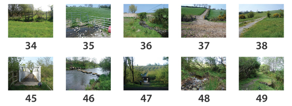
Image two, detail, examples of connections.
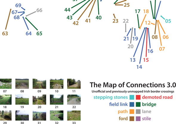
Image three, detail.
Click here for blog entries relating to The Map of Connections.
THE MAP OF ENCOUNTERS
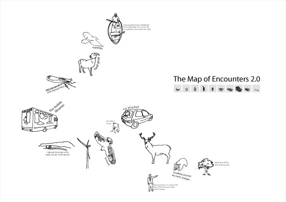
Image one, overview.
In contrast to other maps I've made, where elements had to meet certain criteria, potential elements for The Map of Encounters went through an instinctual filtering. The selection process can be described as this: did I want to tell people about the encounter, whatever it was, when I got home? If I did, it may have had a place on the map. The Map of Encounters is map of stories, the scrapbook record of a journey.
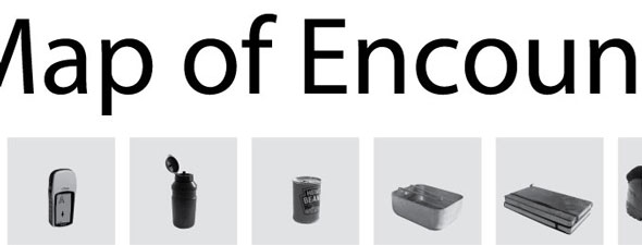
Image two, detail.
Click here for blog entries relating to The Map of Encounters.
THE MAP OF WATCHFUL ARCHITECTURE
For The Map of Watchful Architecture I only concerned myself with defensive architecture along the Border. As the map followed a border it came out as a wavy line of points. This was largely artificial, I only charted architecture within the Border corridor, but was not entirely artificial. That linear landscape has long been staked-out by the regularity of certain kinds of architecture. The 1st/2nd century Black Pig’s Dyke and Dorsey correspond with today’s Border. The concentration of souterrains in north Louth indicate that it may have been a volatile interface zone in later centuries. In 1618 Londonderry and its walls were built. Further north and two centuries later, Martello Towers were constructed to watch over Lough Foyle. During the Second World War pillboxes and observation posts were manned along the Border, close to what was now an international frontier. Then came the Operation Banner installations built during The Troubles. All this adds up to be one of the longest unbroken traditions of defensive architecture anywhere in Western Europe, a tradition some thought finally broken as the last of the Operation Banner towers were de-installed in 2007. But, take a bus south across the Border and you will often be pulled over by the Garda Síochána. They ID check the passengers in an attempt to stop illegal immigration via the UK. What about illegal immigrants who walk through the fields or along quiet lanes? They will have understood the Border is not really how it seems on most maps. It is not a solid line, it is a row of points.
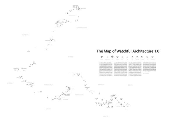
Image one, overview.
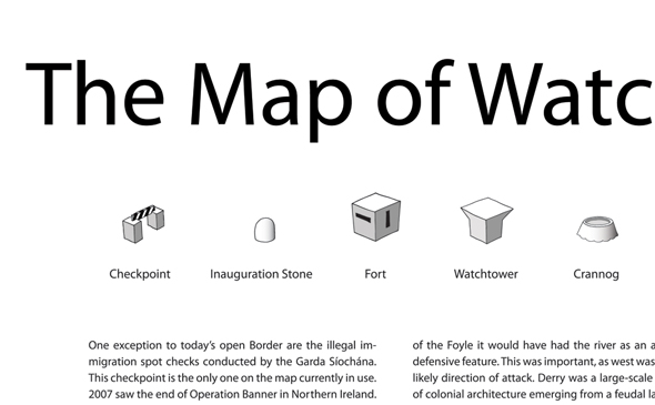
Image two, detail.
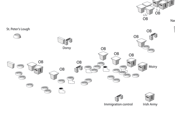
Image three, detail.
Click here for blog entries relating to The Map of Watchful Architecture.
Click here for blog entries about maps of Ulster other than my own.
|